
- TOP
- Search using keywords
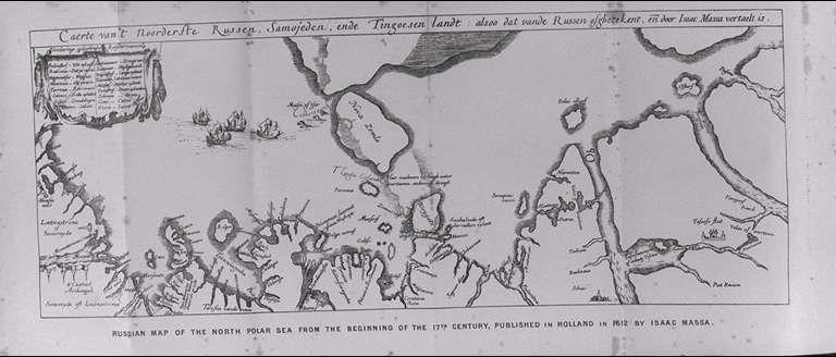
- 17世紀初頭のロシアの北極海地図,イサーク・マッサが1612年にオランダで発行したもの/(Russian map of the North Polar Sea from the beginning of the 17th century, published in Holland in 1612 by Isaac Massa.)
17世紀初頭のロシアの北極海地図,イサーク・マッサが1612年にオランダで発行したもの/(Russian map of the North Polar Sea from the beginning of the 17th century, published in Holland in 1612 by Isaac Massa.)
![]()
![]()
Related Image
Showing 181 of 89-96 Results (total 23page)


| caption | : | 17世紀初頭のロシアの北極海地図,イサーク・マッサが1612年にオランダで発行したもの/(Russian map of the North Polar Sea from the beginning of the 17th century, published in Holland in 1612 by Isaac Massa.) |
| note | : | |
| book title | : | アジアとヨーロッパを回るヴェガ号の航海:旧世界北海岸沿いの以前の旅行の歴史的再検討とともに(ヴェガ号航海誌:1878−1880) 第1巻 |
| author | : | ノルデンシェルド(ノルデンショルド/ノーデンショルド)/(Nordenskiold, A. E. (Adolf Erik), 1832-1901) |
| year | : | 1881 |
| Library Number | : | G/490/No |
| author | : | 000066126 |
| GID | : | GJ001093 |
| PhotoCD no. | : | 88084 |
International Research Center for Japanese Studies 3-2 Oeyama-cho, Goryo, Nishikyo-ku, Kyoto 610-1192 Japan
Copyright (c)2002- International Research Center for Japanese Studies, Kyoto, Japan. All rights reserved.
![]()