
- TOP
- キーワードで探す
- カウンポールのH.ウィーラー卿の塹壕陣地平面図,公的な測量より/(Plan of Sir H. Wheeler's Intrenchment at Cawnpore. From an official survey.)
カウンポールのH.ウィーラー卿の塹壕陣地平面図,公的な測量より/(Plan of Sir H. Wheeler's Intrenchment at Cawnpore. From an official survey.)
![]()
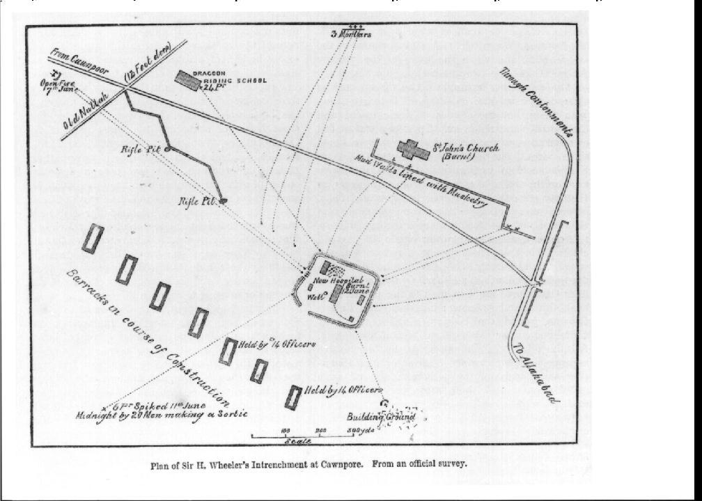

| 被写体 | : | カウンポールのH.ウィーラー卿の塹壕陣地平面図,公的な測量より/(Plan of Sir H. Wheeler's Intrenchment at Cawnpore. From an official survey.) |
| 注記 | : | |
| 掲載書名 | : | インドの反乱とペルシア・中国・日本への遠征の歴史 |
| 編集者名 | : | ドッド,G./(Dodd, G.) |
| 年代 | : | 1859 |
| 請求番号 | : | DS/412/Do |
| 図書ID | : | 000115394 |
| GID | : | GG009038 |
| PhotoCD no. | : |
国際日本文化研究センター 〒610-1192 京都市西京区御陵大枝山町3丁目2番地
Copyright (c)2002- International Research Center for Japanese Studies, Kyoto, Japan. All rights reserved.
![]()