
- TOP
- キーワードで探す
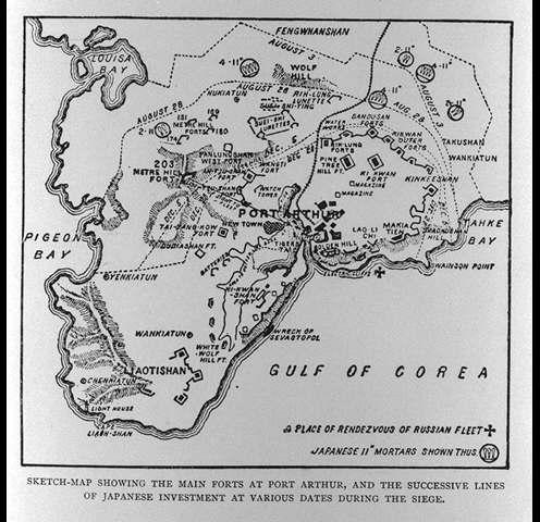
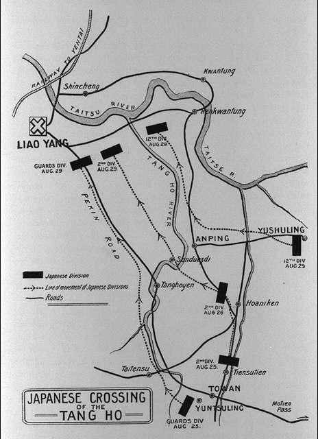
- ポートアーサー(旅順)の主要な要塞と攻囲期間中のいろいろな日における日本の包囲線を示している略図/(Sketch-map showing the main forts at Port Arthur, and the successive lines of Japanese investment at various dates during the siege.)
ポートアーサー(旅順)の主要な要塞と攻囲期間中のいろいろな日における日本の包囲線を示している略図/(Sketch-map showing the main forts at Port Arthur, and the successive lines of Japanese investment at various dates during the siege.)
![]()
![]()
関連画像(同一掲載書の他の画像)
全88枚のうち57-64枚を表示 (全11ページ)
| 
| 
| 
|
| 
| 
| 
|
| 被写体 | : | ポートアーサー(旅順)の主要な要塞と攻囲期間中のいろいろな日における日本の包囲線を示している略図/(Sketch-map showing the main forts at Port Arthur, and the successive lines of Japanese investment at various dates during the siege.) |
| 注記 | : | |
| 掲載書名 | : | 極東における戦争:ロシア・日本の戦闘(日露戦争)の歴史 3,4巻 |
| 編集者名 | : | グルー/(Grew, E. Sharpe) |
| 年代 | : | [190-?] |
| 請求番号 | : | DS/517/Gr |
| 図書ID | : | 000123679 |
| GID | : | GH034016 |
| PhotoCD no. | : | 18081 |
国際日本文化研究センター 〒610-1192 京都市西京区御陵大枝山町3丁目2番地
Copyright (c)2002- International Research Center for Japanese Studies, Kyoto, Japan. All rights reserved.
![]()