
- TOP
- キーワードで探す
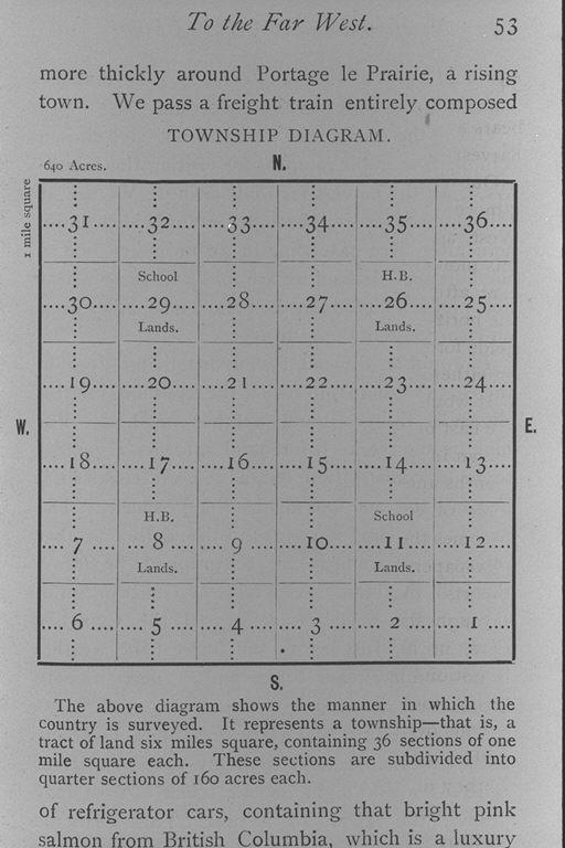
- 郡区図.上の図は地方を測量する方法を示している.各1マイル四方の36区画を含む6マイル四方の区域が1郡区に相当する.これらの区画は各160エーカーの4分の1区画に分割される/(Township diagram. The above diagram shows the manner in which the country is surveyed. It represents a township - that is, a tract of land six miles square, containing 36 sections of one mile square each. These sections are subdivided into quarter ...)
郡区図.上の図は地方を測量する方法を示している.各1マイル四方の36区画を含む6マイル四方の区域が1郡区に相当する.これらの区画は各160エーカーの4分の1区画に分割される/(Township diagram. The above diagram shows the manner in which the country is surveyed. It represents a township - that is, a tract of land six miles square, containing 36 sections of one mile square each. These sections are subdivided into quarter ...)
![]()
![]()
関連画像(同一掲載書の他の画像)
全41枚のうち33-40枚を表示 (全6ページ)
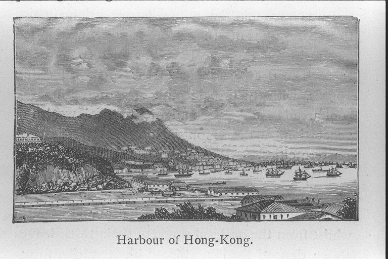
| 被写体 | : | 郡区図.上の図は地方を測量する方法を示している.各1マイル四方の36区画を含む6マイル四方の区域が1郡区に相当する.これらの区画は各160エーカーの4分の1区画に分割される/(Township diagram. The above diagram shows the manner in which the country is surveyed. It represents a township - that is, a tract of land six miles square, containing 36 sections of one mile square each. These sections are subdivided into quarter ...) |
| 注記 | : | |
| 掲載書名 | : | ニューファンドランドからコーチシナへ,金色の波(カナダの小麦地帯?)と新日本と紫禁城を経由して |
| 編集者名 | : | ビンセント(ヴィンセント)/(Vincent, Ethel Gwendoline, b. 1861) |
| 年代 | : | [189-?] |
| 請求番号 | : | G/480/Vi |
| 図書ID | : | 000143206 |
| GID | : | GM009006 |
| PhotoCD no. | : | 170089 |
国際日本文化研究センター 〒610-1192 京都市西京区御陵大枝山町3丁目2番地
Copyright (c)2002- International Research Center for Japanese Studies, Kyoto, Japan. All rights reserved.
![]()