
- TOP
- キーワードで探す
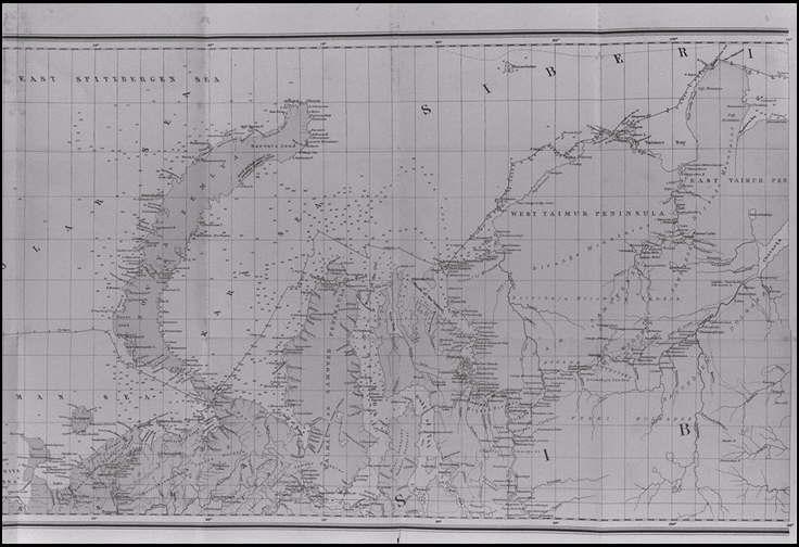
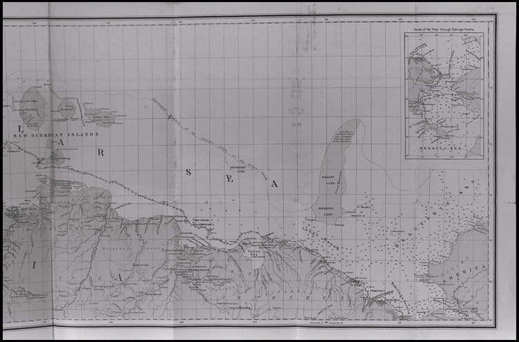
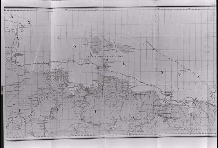
- 古今の資料とヴェガ号航海中の観察に基づくノルウェーからベーリングの海峡までの旧大陸北岸地図.付ヴェガ号探検隊の航跡.参謀長N.セランダー作成(左から2番目)/(Map of the North Coast of the Old World from Norway to Behring's Straits, with the track of the Vega, constructed from old and recent sources, and from observations made during the Voyage of the Vega, by N. Selander, Captain in the General Staff.)
古今の資料とヴェガ号航海中の観察に基づくノルウェーからベーリングの海峡までの旧大陸北岸地図.付ヴェガ号探検隊の航跡.参謀長N.セランダー作成(左から2番目)/(Map of the North Coast of the Old World from Norway to Behring's Straits, with the track of the Vega, constructed from old and recent sources, and from observations made during the Voyage of the Vega, by N. Selander, Captain in the General Staff.)
![]()
![]()
関連画像(同一掲載書の他の画像)
全139枚のうち137-139枚を表示 (全18ページ)
| 被写体 | : | 古今の資料とヴェガ号航海中の観察に基づくノルウェーからベーリングの海峡までの旧大陸北岸地図.付ヴェガ号探検隊の航跡.参謀長N.セランダー作成(左から2番目)/(Map of the North Coast of the Old World from Norway to Behring's Straits, with the track of the Vega, constructed from old and recent sources, and from observations made during the Voyage of the Vega, by N. Selander, Captain in the General Staff.) |
| 注記 | : | |
| 掲載書名 | : | アジアとヨーロッパを回るヴェガ号の航海:旧世界北海岸沿いの以前の旅行の歴史的再検討とともに(ヴェガ号航海誌:1878−1880) 第2巻 |
| 編集者名 | : | ノルデンシェルド(ノルデンショルド/ノーデンショルド)/(Nordenskiold, A. E. (Adolf Erik), 1832-1901) |
| 年代 | : | 1881 |
| 請求番号 | : | G/490/No |
| 図書ID | : | 000066134 |
| GID | : | GJ002137 |
| PhotoCD no. | : | 91009 |
国際日本文化研究センター 〒610-1192 京都市西京区御陵大枝山町3丁目2番地
Copyright (c)2002- International Research Center for Japanese Studies, Kyoto, Japan. All rights reserved.
![]()