- TOP
- キーワードで探す
- 県に分けられた日本地図<蝦夷をのぞく>.注.かっこ内は国名/(Map of Japan (excepting Yezo) divided into ken. Note. The names in parenthesis are provinces.)
県に分けられた日本地図<蝦夷をのぞく>.注.かっこ内は国名/(Map of Japan (excepting Yezo) divided into ken. Note. The names in parenthesis are provinces.)

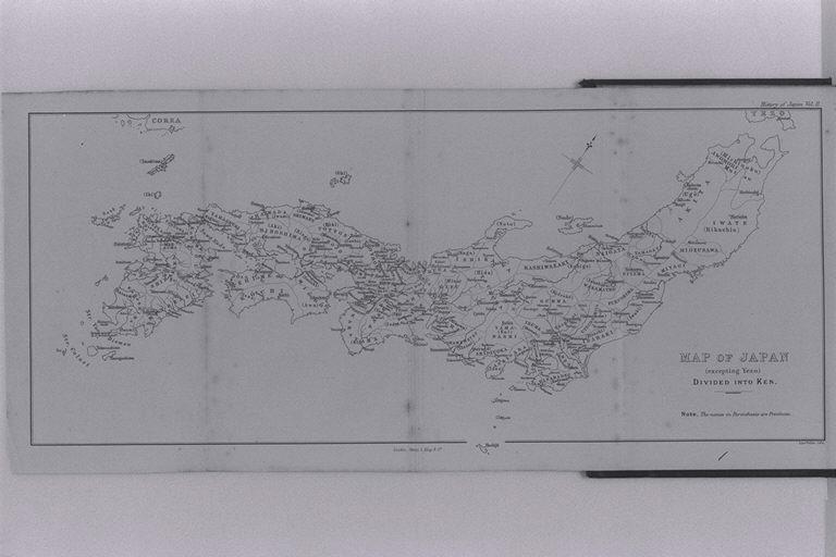

| 被写体 | : | 県に分けられた日本地図<蝦夷をのぞく>.注.かっこ内は国名/(Map of Japan (excepting Yezo) divided into ken. Note. The names in parenthesis are provinces.) |
| 注記 | : | |
| 掲載書名 | : | 日本の歴史:もっとも昔の時代から現在まで 第2巻 |
| 編集者名 | : | アダムズ(アダムス)/(Adams, Francis Ottiwell) |
| 年代 | : | 1875 |
| 請求番号 | : | DS/835/Ad |
| 図書ID | : | 001000223 |
| GID | : | GK003002 |
| PhotoCD no. | : | 114048 |


国際日本文化研究センター 〒610-1192 京都市西京区御陵大枝山町3丁目2番地
Copyright (c)2002- International Research Center for Japanese Studies, Kyoto, Japan. All rights reserved.