- TOP
- キーワードで探す
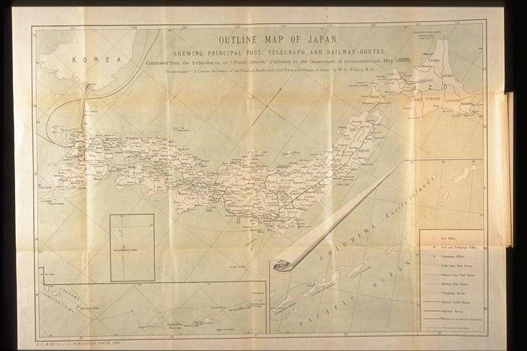
- 日本の基本図.主要な郵便,電信,鉄道線路を示している.1888年5月に逓信省によって発行された郵便線路から縮小された/(Outline map of Japan. Shewing principal post, telegraph and railway routes. Condensed from the Yubin-sen-ro, or "Postal routes," published by the Department of Communications, May 1888.)
日本の基本図.主要な郵便,電信,鉄道線路を示している.1888年5月に逓信省によって発行された郵便線路から縮小された/(Outline map of Japan. Shewing principal post, telegraph and railway routes. Condensed from the Yubin-sen-ro, or "Postal routes," published by the Department of Communications, May 1888.)
![]()
関連画像(同一掲載書の他の画像)
全2枚のうち1-2枚を表示 (全1ページ)
| 被写体 | : | 日本の基本図.主要な郵便,電信,鉄道線路を示している.1888年5月に逓信省によって発行された郵便線路から縮小された/(Outline map of Japan. Shewing principal post, telegraph and railway routes. Condensed from the Yubin-sen-ro, or "Postal routes," published by the Department of Communications, May 1888.) |
| 注記 | : | |
| 掲載書名 | : | 日本の主な道路,主要な町と村の簡潔な辞典 |
| 編集者名 | : | ホイットニー(ホイットニ/ホイトニー)/(Whitney, Willis Norton) |
| 年代 | : | 1889 |
| 請求番号 | : | GB/11/Wh |
| 図書ID | : | 001257419 |
| GID | : | GK066002 |
| PhotoCD no. | : | C023046 |


